The Scenic Rim is a place of stunning and surprising beauty – surprising even for Brisbane and Gold Coast locals, who are more often familiar with Southeast Queensland’s beaches than its lush hinterland.
A great way to get to grips with the region is on one of the many brilliant Scenic Rim hikes. These walks trace their way through ancient Gondwana rainforest, across primordial ridge lines and past surging waterfalls.
The best thing? There’s something for everyone, with walks ranging from just 45 minutes in duration to four-day odysseys that cover 47 kilometres of undulating tracks and trails.
Keen to tackle some of the best Scenic Rim walks? Here’s a guide.
#Half day or less
#Curtis Falls Track
This lovely, laidback walking track is easily accessed via Mount Tamborine, making it ideal for families staying in one of the nearby hotels or B&Bs, or those after something they can knock off in less than an hour.
Hidden just off Eagle Heights Road, a short drive from the mountain village’s popular high street, the walk starts by weaving its way down between towering eucalypts, before hitting lush rainforest closer to Cedar Creek. The walk then meanders upstream towards Curtis Falls itself, which is a lovely picturesque spot to grab an Instagram pic, before you make the return walk back towards the car park.
This Scenic Rim hike is best tackled after a bit of rain, when the falls are flowing (although things can get a little too gnarly at peak wet season, so pick your day wisely), and there's a lovely cafe, The Pavillion Mt Tamorine, at the car park, if you need some refreshments afterwards.
#Mount Mathieson Circuit
Before the Cunningham Highway wound its way through Cunninghams Gap, there was Spicers Gap Road to the south. Constructed between 1859 and 1865, this well- preserved thoroughfare – designed at the time to better connect Brisbane to the rich farmlands beyond the Great Dividing Range – curls its way through Spicers Gap Conservation Park.
The best way to see it is by walking the Mount Mathieson Circuit. This fabulous three-hour Scenic Rim walk begins at the Pioneer picnic area on Spicers Gap Road and sets off into open eucalypt forest, before arriving at the peak of Mount Mathieson, overlooking the Cunningham Highway. From there, it continues along a ridge line into rainforest, before turning onto the historic section of Spicers Gap Road, which has information stations dotted along its route.
The road spits you out at Governors Chair Lookout, which boasts some of the best views in the entire region, and from there it’s an easy 20-minute walk back down to the car park. This is one of the best all-round trails in the region, perfect for casual bushwalkers, or a family with older kids who are beginning to get into their hiking.
#a day or less
#Border Track
One of the most iconic Scenic Rim walks, the Border Track is the big daddy of Lamington National Park’s hiking trails, with many other tracks branching off it at various points.
This walk traces the Queensland-NSW border and is typically tackled as a seven-hour one-way effort, with shuttle buses from the two trailheads at Binna Burra Lodge and O’Reilly’s Rainforest Retreat, running one-way Saturday morning transfers to the opposite end of the track.
The hike takes you along exposed ridge lines, through subtropical and temperate rainforests and over bubbling mountain streams.
The views along the way are spectacular, particularly on a relatively short side track that leads to two lookouts, Beereenbano and Merino, which boast awesome views over the Tweed and Limpinwood valleys. You’ll also get terrific views of the spectacular Wollumbin (Mount Warning) at other points along the trail.
It’s an undulating walk, but starting at O’Reilly’s means you’re heading slightly more downhill. Either way, book some accommodation at either end so you can rest your weary bones in style.
#Mt Barney
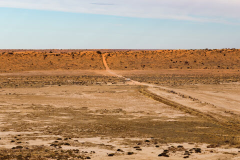
One for the adventurers, this intimidating looking peak rises from the surrounding plains like an enormous monolith and makes for one of the most challenging hikes in Southeast Queensland. But the rewards at the summit are views second to none, looking across to Mount Maroon, Mount Ernest, Mount Lindesay and Maroon Dam.
There are two ways to reach the summit. Allow eight to 10 hours to ascend the East Ridge route. The South East Ridge route is quicker but steeper, and requires more fitness. Both routes descend via the East Ridge.
One of the best ways to experience this mountain hike is with a stay at Mt Barney Lodge. This fabulous eco-lodge 90 minutes southwest of Brisbane runs different expeditions up the mountain with experienced guides, meaning you’re never in danger of losing your way and will learn about the flora and fauna as you go.

📸 Tourism and Events Queensland

📸 Tourism and Events Queensland

📸 Tourism and Events Queensland
#MULTI-DAY
#Scenic Rim Trail
Billed as Queensland’s first “great walk”, the four-day Spicers Scenic Rim Trail is about as posh as hiking gets in this part of the world.
Yes, it’s a multi-day Scenic Rim walk, but you can forget about sleeping in tents, or hauling your gear with you, with Spicers shipping your luggage each day as you walk 47 kilometres along the ridge of Main Range National Park, staying in fabulous, modern eco-cabin accommodation along the way.
The Scenic Rim Trail itself weaves in and out of Gondwana rainforest that is 180 million years old, and takes in both Indigenous and European settler history. The range was a natural border between the Yuggera, Bundjalung and Barunggam peoples – a place where many would pass to travel to bunya festivals in the distant Bunya Mountains – and would later become the location of a busy timber-getting operation.
At $3999 per person, it’s not cheap, but the price includes elevated, produce-driven breakfasts and dinners, hearty packed lunches, and all-inclusive booze. Each group is accompanied by two guides and the accommodation is staffed all along the walk. Still, the Scenic Rim Trail is open to the public too, if you want to pack your own tent and do it that way – you’ll just need to book a night at all three campsites along the way.
If you’re after something more digestible, you can do just the final stretch of the walk as a self-guided return trip up past Mount Cordeaux from the Cunningham’s Gap car park, hiking up to the Bare Rock Lookout and back in about four-and-a-half hours. The views from Bare Rock are jaw-dropping, with the Scenic Rim below you to the east and the plateaus of the Southern Downs to the west.